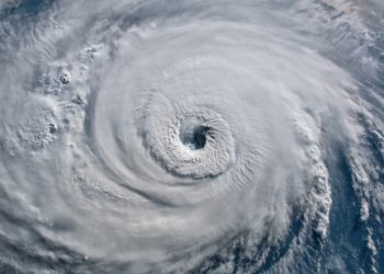


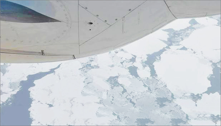
NOAA researchers set out this week on a two-week mission to fly over the Arctic to measure how much the ice has melted over the summer and gauge the speed of this fall’s refreezing of sea ice. According to the National Snow and Ice Data Center, 2014’s minimum sea ice extent was 1.94 million square miles, the 6th smallest on record. Aboard a NOAA Lockheed WP-3D Orion aircraft, a highly specialized four-engine turboprop known for its work as a hurricane hunter, researchers will use scientific instruments to measure the extent of this summer’s melt before the ice begins freezing for winter. The Tampa, Florida-based aircraft will operate out of Fairbanks International Airport.
This is the second year in a row scientists have flown above Arctic waters. Data gathered from both years is testing a hypothesis that increased summer heat stored in the newly sea-ice free areas of the Arctic Ocean lead to surface heat fluxes in autumn that are large enough to have impacts on atmospheric temperature, humidity, wind and cloud distributions.
James Overland, Ph.D., Arctic researcher with NOAA’s Pacific Marine Environmental Laboratory in Seattle said:
“Both the sea ice area and its thickness have been decreasing dramatically during the last decade. This is an indicator of global climate change, and is contributing to changes in storms, habitat for wildlife, and is opening up Arctic waters to increased shipping and exploration for resources.
“The Arctic climate is warming three times faster than the lower latitudes due to a process called Arctic amplification. Modest warming in the mid-latitudes is amplified in the Arctic as there is less sea ice, which opens up waters that no longer reflect sunlight as light-colored ice does, and instead absorb heat, setting off other changes to the ecosystem.
“There is considerable year to year and region to region variability, but over the last 15 to 20 years, we’ve lost 60 percent of the total amount of ice that used to be in the Arctic.
“We have satellite pictures of what happens on the sea ice surface that we can compare from year to year. The NOAA P-3 aircraft is designed to operate at low levels down to 200 feet, so we can see the ice as well as ice-free areas. We use instruments aboard the plane to calculate heat loss by measuring temperature, wind, humidity, and solar and long-wave radiation.
“We are flying with highly accomplished NOAA Corps pilots and crew who know how to fly in Arctic weather conditions and how to help us get high quality data. Our science team is from NOAA’s Pacific Marine Environmental Lab and NOAA’s Joint Institute for the Study of the Atmosphere and the Ocean at the University of Washington. We’ll also work with our colleagues from the University of Alaska at Fairbanks.
Results from this mission will be used as part of NOAA’s Arctic Report Card–an annual report that provides an update on changing conditions in the Arctic environment.
Source and Image Credit: NOAA
In the origin, I was straightforward with you propecia before and after has changed my essence. It has become much more fun, and now I have to run. Just as it is incredible to sit.