


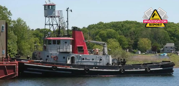
The National Transportation Safety Board (NTSB) has published an investigation report into an incident where the towing vessel Nickelena, while transiting the Straits of Mackinac, struck the Mackinac Bridge.
The incident
On May 7, 2023, about 0213 local time, the towing vessel Nickelena was transiting the Straits of Mackinac while towing deck barge BMI 209, transporting a crawler crane, when the crane boom struck the main span of the Mackinac Bridge. The contact bent the crane boom backwards, causing the boom to eventually collapse onto the aft end of the barge. There were no injuries, and no pollution was reported. Damage to the Mackinac Bridge was estimated at $145,000; damage to the crane was estimated at $665,000.
Analysis
About 0200 on May 7, shortly after passing eastward under the main suspension span of the Mackinac Bridge, the crew of the commercial towing vessel Nickelena discovered that the crane they were towing 500 feet astern (aboard deck barge BMI 209) had struck the bridge and collapsed onto the barge.
Before departure, managers from the towing vessel operating company visually estimated the angle of the boom to be between 50° and 60° and believed that, with its 5-foot “rooster” sheave attached, the boom was 145 feet in length (the boom was 160 feet long). Using their visual estimation of the crane’s boom angle and their boom length estimate, both of which were incorrect, they believed that the boom was at a safe height for the transit. The managers told the Nickelena captain, “everything’s secured, ready to go.”
The damage to the Mackinac Bridge structure indicates that the first contact was to the stiffening truss below the roadway, at the top of the truss’s bottom chord (about 155 feet above the water). Given the configuration of the crane, the wires securing the crane boom would have hit first, and then when they parted, the boom would have contacted the top of the chord. As the barge continued forward, the boom would have been pushed backwards and its angle and height above the water would have increased, leading to damage higher up on the bridge. At some point, the boom contacted the upper diagonal truss (U95–L96), about 183 feet above the water, before folding back and collapsing on the barge.
An NTSB study used video of the crane barge on the day of contact to determine that a boom elevation angle for the crawler crane over about 55° would contact the truss bottom chord of the bridge with the barge near the center of the channel. The study determined that the boom angle during the voyage and before contact with the bridge was about 62°, corresponding to a boom height of 162.3 feet above the water.
Similarly, a post-casualty Coast Guard analysis determined that if the boom angle was 60 degrees (the high end of the towing company managers’ estimate), the end of the 160-foot-long boom with an attached 5-foot rooster sheave would have been about 165 feet above the water level. Given the vertical clearance of 153 feet for the Mackinac Bridge at the time of the contact, the crane was about 10 feet too high to transit under the bridge (not including an additional safety margin).
Towing vessel operations are required to have a TSMS, which is a formal, documented system for owners and operators to ensure that rules and procedures related to safe operations are in place. A properly implemented TSMS is an effective tool for safety oversight; it is designed to reduce human error and create a culture of safety.
Probable cause
The National Transportation Safety Board determines that the probable cause of the contact of the Nickelena’s towed crane on deck barge BMI 209 with the Mackinac Bridge was the captain’s and barge company managers’ ineffective voyage planning, which did not identify that the crane being towed was too high to pass safely under the bridge.
Lessons vearned
Verifying navigation risks when voyage planning
For vessels and tows with high air drafts, such as crane barges, bridges pose a risk of overhead contact. Operators should ensure they have the most accurate and objective data about the crane and bridge heights before getting underway. Appropriate navigational resources, such as the US Coast Pilot or navigational charts, should be consulted by owners and operators when developing voyage plans to assess navigation risks and hazards, including the air draft relative to bridge vertical clearances along the intended route.