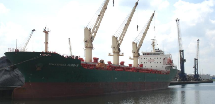
Transport Malta released its investigation report, regarding the accident on 13 May 2017, with the Maltese registered bulk carrier Universal Durban. The ship while on passage from Bell Bay, Tasmania to Bintulu, Malaysia, ran aground on a shoal at 12 knots, South of the island of Pulau Serasan. The vessel sustained minor damages in the bow area and bottom shell plating.
The incident
On 28 April 2017, Universal Durban sailed from Bell Bay, Tasmania, for Bintulu in Borneo, Malaysia. Before the departure from Bell Bay, ENCs for the voyage were selected using Chartplanner and a purchase order was made to Datema. A permit file was installed on ECDIS and the second mate prepared a passage plan with an XTD limit of 250 m. A safety alarm for safe water depth/contour was set at 12 m. The planned route was visually checked by the second mate and by ECDIS auto-scan route check function. No safety alarms were triggered and the passage plan was approved by the master. During the voyage, ENCs were updated.
[smlsubform prepend=”GET THE SAFETY4SEA IN YOUR INBOX!” showname=false emailtxt=”” emailholder=”Enter your email address” showsubmit=true submittxt=”Submit” jsthanks=false thankyou=”Thank you for subscribing to our mailing list”]
During the course of the watch, the master observed breakers on the starboard side and expressed doubt on the accuracy of the charted objects displayed on ECDIS. A little later he set the autopilot on a course of 014° to keep clear of the nearest isolated danger.
When the master left the bridge, he instructed the OOW to call him as soon as he sights breakers. At the time, the water depth readings were about 19 m below the keel. At 11.55, the OOW reportedly observed ‘abnormal’ waves about a mile on the starboard beam and called the master. It was recalled that the soundings quickly dropped and within a minute of calling the master, the speed dropped from 12 knots to zero.
A minute later, the Universal Durban was reported stranded.
Universal Durban was re-floated and anchored off Pulau Serasan for a damage survey by the Classification Society surveyor. On 28 May 2017, the following damages were reported by the surveyor:
- Minor indentations in the bow area and in way of cargo hold no. 1;
- Starboard bilge keel (2m in length) slightly bent;
- Superficial scratch marks covering an area from the bow to the port bilgekeel, abreast of cargo hold no. 2.
Probable cause
The safety investigation revealed that the scale of digital chart in use on ECDIS was unsuitable for the area and the quality of data encoded within
the composite data quality attribute of that chart was not within the thresholds defined by the category of zone of confidence.
Moreover, the investigation concluded on the following:
- ENC ID300428 was inadvertently deleted while preparing an Order File on Chartplanner;
- The passage plan prepared by the navigational officer deviated from the designated ASL for the Indonesian Archipelago;
- Visual route check by the OOW was cursory and the master did not crosscheck the passage on ECDIS;
- Digital chart permits received from Datema were not checked before uploaded to ECDIS;
Recommendations
The East Asia Hydrographic Commission was recommended to review the ENC production process in order to ensure that CATZOCs are populated with meaningful values, commensurate with quality of data survey.
See more information in the PDF herebelow


