The US National Oceanic and Atmospheric Administration (NOAA) Coast Survey announced launch of hydrographic expeditions through July and August to discover what lies underneath the water’s surface. Currently only 4.1% of the US maritime Arctic has been charted to modern international navigation standards.
Alaska is one-fifth the size of the contiguous US, and has more than 33,000 miles of shoreline. In fact, the Alaskan coast comprises 57% of the United States’ navigationally significant waters and all of the US’ Arctic territory.
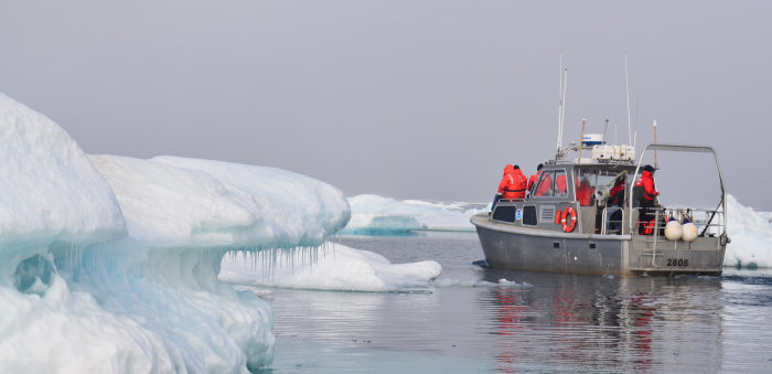
In part, Arctic waters are difficult to survey because of the sheets of sea ice persist throughout the majority of the year. Traditionally, thick ice sheets have restricted the number of vessels that travel in the area.
But Arctic ice is declining and sea ice melt forecasts indicate the complete loss of summer sea ice in the Arctic Ocean as early as two or three decades from now, meaning year-round commercial vessel traffic is likely to increase.
Given the vast expanse of ocean to be charted in the US Arctic, Coast Survey determined charting priorities and coordinated activities in the US Arctic Nautical Charting Plan, the third issue of which was released in August 2016. The plan proposes 14 new charts and was created following consultations with maritime interests, the public, and federal, state, and local governments.
As such, in July and August, the crew aboard the NOAA Ship ‘Fairweather’ is fulfilling a piece of the US Arctic Nautical Charting Plan as they conduct 566 square nm of hydrographic surveys in the vicinity of Cape Lisburne and Point Hope, Alaska. 70% of this area has never been surveyed, while the remaining 30% has only lesser bottom coverage from single beam surveys conducted in the early 1960s.
The data will be used to produce nautical charts that align with Coast Survey’s new rescheming efforts as stated in the National Charting Plan. This is one of seven hydrographic surveys NOAA has planned in Alaska for 2018…The benefits of surveying extend beyond safe navigation. Accurate seafloor depths are important for forecasting weather, tsunami, and storm surge events that affect local communities. Bathymetric data also informs the discovery of seabed minerals, historic wrecks, and natural resource habitat mapping.


