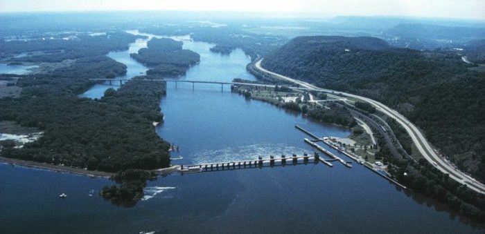
As the Swedish Club said, citing information from Fernandes Maritime Consultants, the Mississippi River is currently experiencing its lowest water levels in over a decade due to a severe midwest draught situation.
This has caused upriver supply chain interruptions to barge traffic transporting grain and other cargoes as well as groundings of ocean-going vessels traversing up and down the Lower Mississippi River’s (LMR) navigable channels up to Baton Rouge, Louisiana, approx. Mile 139 AHP (Above Head of Passes).
The US Army Corp of Engineers is working diligently dredging sections of the River to maintain or restore normal traffic conditions, however fighting nature is not always a winning hand.
How can Masters avoid ships running aground
#1 Stay abreast of the latest updates: The Army Corps as well as the three pilots’ associations responsible for navigating vessels along the approx. 160 miles of navigable waterway between the Southwest Pass and Baton Rouge, issue periodic (daily) updates on the navigable depths of water along the Mississippi River. Remember, these depths are not uniform throughout with water depths reducing as one goes upriver. This information is sent to the Master by his local agent. The Master is to make sure that receives and applies them (Passage Planning).
In addition, The US Coast Guard issues “Marine Safety Information Bulletins” (MSIB) when necessary, advising the maritime transportation fraternity on precautions to be taken in the event of extreme river or weather conditions. Accordingly, the Captain of the Port, Sector New Orleans, has issued a safety advisory volume number XXII, issue 053, noting water of the LMR from Mile Marker (MM) 0.0 to MM 167.5 AHP because of lower water conditions. The safety advisory was needed to protect vessel and mariners from hazards associated with low water, including possible shoaling and decreased channel widths.
#2 Remain within the navigation channel: While maneuvering in the Mississippi River, remain within the navigation channel. The Army Corps has designated a navigation channel towards the center of the Mississippi River where they assure a specific depth of water, generally 45 ft (13.72 m) – 47 ft (14.33 m). Do not exit that channel (other than to berth or anchor). Sounds simple, and yet ships exit the channel at their own risk and peril. When asked, Masters generally point to the pilot. True, but when an incident occurs, the pilot shrugs and points to the Master being in-overall command, a fact enshrined in every SMS. The pilot is only there to assist in navigation.
#3 Shoaling “Mud Lumps”: The ECDIS and river depths are based on survey results carried out periodically by the Army Corps but not continuously. On the other hand, the Mississippi River along its nearly 4,000 kms. route from the Canadian border brings down along with it, on average, about 600,000 Tons of mud and silt each day. This silt gets dropped on the riverbed notably where a change of flow is encountered, for example, at a bend in the river or where it encounters a sudden change in depth or at the river delta. The silt deposited is generally soft and is colloquially called “gumbo mud”. Such shoaling is also locally termed a “mud lump”. During low water, such mud lump formation can be critical.
#4 Overloading: At loading berths, often, there is considerable pressure put on vessel Masters to overload on several pretexts, the minimum depth available being at zero gauge height being a prominent one. Do Not succumb to such pressures. These folks who offer such assurances melt into the night the moment a ship touches bottom. Again, the importance of proper Passage Planning, UKC, and Squat cannot be overemphasized at all times but particularly during the prevailing low water conditions.


