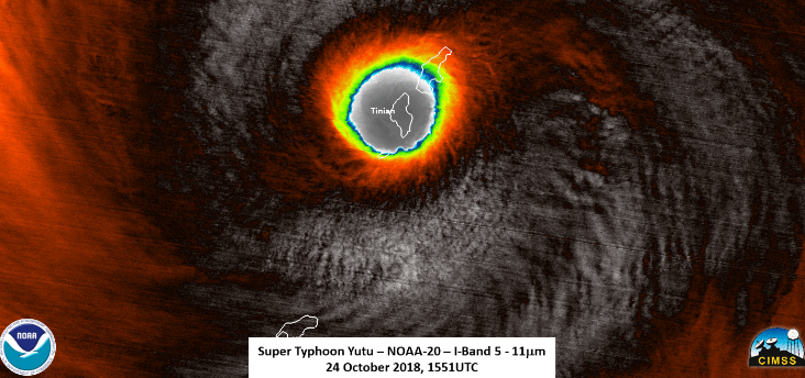
Category 5 Super Typhoon Yutu has pushed west of the islands of Saipan and Tinian in the US Commonwealth of the Northern Mariana Islands. Yutu may eventually arrive in the Philippines, Taiwan or southern Japan next week, according to data provided by the US National Weather Service.
At the moment, maximum sustained winds remain solidly Category 5 intensity, near 175 mph, as of the latest advisory from the US Joint Typhoon Warning Center.
Based on satellite estimates, Typhoon Yutu (bearing down on Saipan) is one of the most intense tropical cyclones we’ve observed worldwide in the modern record. This is an historically significant event,
…said FEMA atmospheric scientist Michael Lowry via social media.
Overnight, Yutu grew rapidly from a Category 1 storm (75-mph) to a Category 5 (180-mph) storm in 36 hours.
Yutu will gradually weaken as it moves west-northwestward into the Philippine Sea, but will remain a potent Category 3 or 4 equivalent typhoon through at least Monday.
Gusty winds will continue to lash Saipan, Tinian and Rota through late Thursday morning local time. Guam and the Northern Mariana Islands are 14 hours ahead of US EDT.


