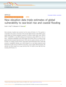
A study launched in 2019 presented the results of a survey concerning people currently occupying global land below projected high tide lines for 2100 under low carbon emissions, up from 110 M today, for a median increase of 80 M.
The study highlights that
Translating sea-level projections into potential exposure of population is critical for coastal planning and for assessing the benefits of climate mitigation, as well as the costs of failure to act.
Moreover, the study highlighted that the analysis includes future water level projections with contemporary population densities, meaning that the results should not be conceived as projected impacts. On the contrary, the results of the survey represent the portion of presently developed land at risk in the future, which we interpret as a threat indicator.
Overall, the focus of the study is estimating populations occupying land below future high tide lines or annual flood levels, but results showed that some 110 M people live below MHHW today.
Accordingly, the study explains that:
- Elevation error may drive the finding. However, in the US and Australia, CoastalDEM identifies fewer people living below MHHW (0.9 M and 69,000, respectively) than lidar-based analysis does (1.7 M and 75,000), consistent with our more general finding that CoastalDEM tends to underestimate coastal exposure relative to lidar.
- other sources of error may be important, including from the population data used and from the sea level data and tidal models used to determine local MHHW. Higher accuracy and higher resolution population, sea level and tidal inputs are likely important for improving coastal exposure assessments in the future.
- many people today do in fact live on land below (or just above) MHHW, behind the protection of levees or other defenses. In the US, these account for 0.8 M out of the 0.9 M residents that our more detailed lidar analysis identifies as today occupying land below MHHW. Globally at present, levees and seawalls protect low-lying populations in many major deltas, such as around Shanghai, the Netherlands and New Orleans, and in areas experiencing rapid subsidence, such as parts of Jakarta and Tokyo. However, levee location data are not globally available, to our knowledge, and so are not incorporated into this analysis.
- Fourth and finally, many people today do live in unprotected areas subject to frequent coastal flooding (if not below the high tide line), such as in Bangladesh, or in boats or structures on or above the water (such as homes on stilts). These possibilities are likely to be most common in developing countries, and to be poorly documented.
Concluding, you may learn more about the study by clicking herebelow


