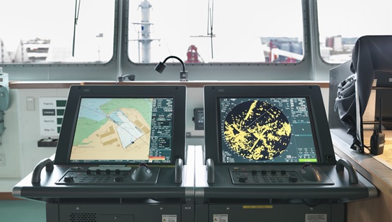
ECDIS is an important milestone for shipping, marking the industry’s transition from paper to digital navigation. The ECDIS installation schedule is coming to an end in July 2018, therefore, more and more vessels are embracing electronic navigational charts as the primary means of navigation over a paper chart system.
Considering that most accidents are contributed to the human element, ECDIS has come along in order to try and change the landscape. However, there are many cases which showcase the new technology involves many challenges that cannot be ignored. The improper use of ECDIS can result in accidents; therefore a change in operators’ mindset is required.
ECDIS is a highly complex and sophisticated system, which besides the navigational functions includes components of a computer-based information system delivering a real-time display of the navigator’s own vessel located with reference to the surrounding sea area. The ECDIS system is based on the process of information received by several sensors connected to the system (position system, AIS , Log, Compass, Radar, NAVTEX ect), and the mapping of this information on a chart display system. An ECDIS system includes not only the visualization of all paper chart information on a computer screen, but also provides a wide range of other data required for navigational purposes
As goes with all cases, firstly, it is important to identify the risks and not to show over-reliance on this new technology. For that purpose, a close look to the system itself is required. Industry stakeholders have discussed a lot about the pros and cons of paperless navigation concluding that ECDIS does have an edge over the traditional paper chart navigation.
What may go wrong
- Over-Reliance. With an equipment which is seemingly fool-proof, there is a tendency for navigators to over rely on it.
- Too much information on screen may cause clutter and can be distracting. The navigator may lose critical minutes on non-important items while decisions should be taken.
- Complacency due to automatic plotting of position. As positions on paper charts were “past positions” the navigator continually checked them again and again. Now the real time position creates a false safe emotion and the felling that a last time response will be enough.
- Wrong settings. Considering that ECDIS is an equipment system, if wrong settings are installed, the information provided to navigator will not be accurate. Just try it by your own. Put the safety depth to 10m and see the navigationable sea area and do the same with 20m safety depth. The difference of the area may lead to accidents as the safety felling is created by wrong parameters.
- Alarm Fatigue. If alarms start going off too frequently, the navigator could end up in the situation of acknowledging the alarm even without checking what it was. Eventually he will run out of luck and there could be an occasion where he might miss out on a critical warning such as approaching a danger.
- Different Types. Navigation on paper charts was a skill which had to be mastered just once. It was then just routine practice which kept one in tune with things. However, this does not happen with ECDIS. Different vessels will have different types of ECDIS equipment. Even if the essential features are the same, it still takes a lot of fiddling around until one gets comfortable with the machine.
- Lack of ENCs for certain trading areas which require the additional paper charts carriage.
Benefits of ECDIS use
- Reduced workload for the navigator (charts and nautical publications updating, voyage planning, all information in “one hand”).
- Easy Correction of charts and publications. All experienced navigators may recall in their mind the endless hours of chart and publication corrections. Before the advent of paperless navigation, the largest chunk of the Navigating Officer’s work time was consumed in Correcting Charts. The Navigating Officer now receives weekly updates to the Electronic Charts via Email which he has to download onto a zip drive and upload them to the ECDIS. Even the dreaded T&P notices are now shown electronically on the ECDIS.
- Navigation in real time increasing situational awareness in combination with proper lookout. With the ECDIS system the position display on the chart is the present position. When the paper charts used the position plotted on the chart was the position at the time it was received several minutes ago.
- Accuracy.As many systems are mixed and analyzed the result of actual position and advanced movement is more accurate.
- Easy route monitoring, with all required information displayed in short time.
- Prediction of special maneuvers (predicted path, trial maneuver, docking mode). All the systems also include Man Overboard function and search and rescue functions providing information quickly without much searching.
- Availability of charts, especially those charts required for not programmed voyages. In previous times it was an often practice to start the voyage without some of the voyage charts as they were provided during voyage.
- Access to additional information resources
When it comes to electronic navigation, an emphasis on understanding the possible anomalies of the ECDIS system entirely should always be in mind. Therefore, a change in the mindset of navigation is required for understanding ECDIS limitations and possibilities, including its benefits and disadvantages. Only with an ECDIS-oriented mindset, the navigator will efficiently integrate the system in the ongoing navigational process.
Taking everything into consideration, the navigator should be adequately prepared and vigilant to monitor problems, assess hazards and consider control measures for the system in order to gain the benefits from electronic navigation.


