The Arctic Council’s Working Group on the Protection of the Arctic Marine Environment (PAME) has launched a comprehensive Arctic shipping activity database, to enhance knowledge of historical Arctic ship traffic activity and the factors that affect it, as sea ice extent, meteorological and oceanographic conditions and international regulations. The database is designed to allow authorized users to analyze vessel traffic patterns, fuel use and air emissions, among other economic and environmental conditions.
Specifically, the database includes information from 2005 to 2018 and is regularly updated.
More importantly, the data mostly focus on
- Number of ships in the Arctic, distances sailed and hours operated;
- Location of ships, ship routes and ship speed;
- Ship types, including size and flag;
- Pollution measurements from ships, including CO2 emissions;
- Other environmental information such as sea ice extent.

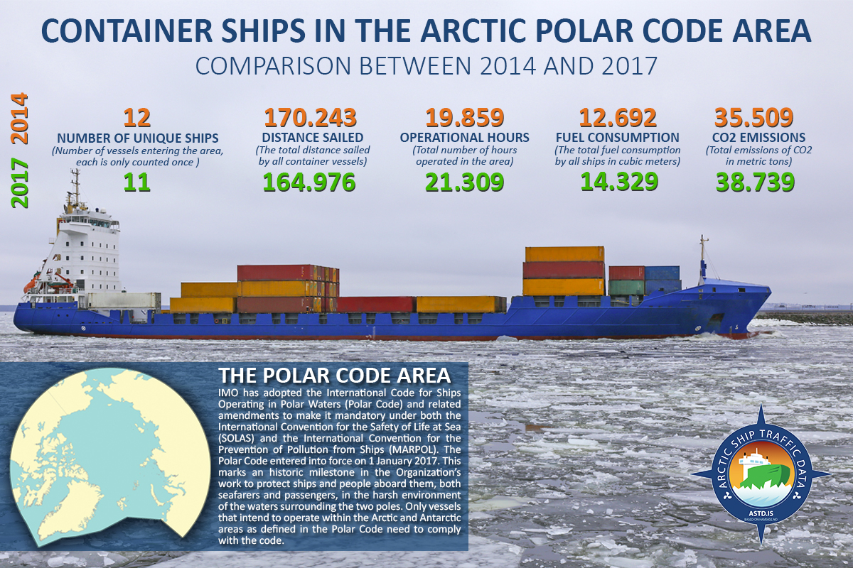
According to the Arctic Council’s Working Group, container ships in the Arctic polar code area have increased and decreased from 2014 to 2017.
For instance, the number of unique ships that passed the Arctic polar code area in 2014 were 12, whereas in 2017 were 11.
Moreover, the total distance sailed by all container vessels was in 2014 170.243, in comparison to 2017 that the total distance was 164.976.
The operational hours reported in 2014 were 19.859 and in 2017 were 21.309.
According to the database, the total fuel consumption by all vessels in cubic metres in 2014 was 12.962, whereas in 2017 it was 14.329.
The total emissions of CO2 in metric tonnes was 35.509 in 2014, and 38.739 in 2017.
The Arctic Shipping Best Practice Information Forum was established in 2017 by the eight Arctic States (Canada, Denmark, Finland, Iceland, Norway, Russia, Sweden and the U.S.) to help raise awareness and to promote the effective implementation of the Polar Code.


