In the UK, there is an increasing number of Offshore Renewable Energy Installations (OREIs). Taking this into consideration, the UK MCA published a guide providing details on the impact of OREIs on navigational safety and emergency response.
Navigational considerations
Operators should assess navigational and communication impacts or difficulties around the site area and surroundings to determine any potential obstruction of, or danger to, seafarers or emergency response services. This assessment will also help to establish the best options to be adopted, including those of operational site monitoring.
[smlsubform prepend=”GET THE SAFETY4SEA IN YOUR INBOX!” showname=false emailtxt=”” emailholder=”Enter your email address” showsubmit=true submittxt=”Submit” jsthanks=false thankyou=”Thank you for subscribing to our mailing list”]
Operators should also consult with local and national search and rescue authorities, and consider the types of aircraft, vessels and equipment which might be used in emergencies. This should include the possible use of OREI structures as emergency refuges and any matters that might affect emergency response within or close to the OREI.
Moreover, operators should also assess the consequences of ships deviating from normal routes and recreational or fishing vessels entering shipping routes in order to avoid proposed sites. It is important to consider any situation which could lead to safety of navigation being compromised, such as:
- An increase in end-on or crossing encounters
- Reduction in sea-room or water depth for manoeuvring – leading to choke points
When considering navigational priority, operators should treat all seagoing water craft, operations and mariners as the same.
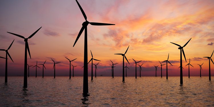
Wind farms
When planning a voyage, mariners should assess all hazards and associated risks, including the proximity of wind farms and turbines, for example:
- Spacing – wind farm turbines are usually spaced 500 metres or more apart depending on the size of the turbine
- Depth of water – most wind turbines operate in relatively shallow water though new generations of wind farm will be constructed in deeper water, possibly restricting navigable channels
- Seabed changes – wind farm structures could, over time, affect the depth of water in their vicinity through scouring of the seabed making depth information unreliable
- Tidal streams – wind farm structures may obstruct tidal streams locally, creating eddies nearby
- Small craft – vessels involved in turbine maintenance and safety duties may be encountered or obscured within or around a wind farm – fishing vessels may also operate and be obscured in the area
- Shore marks – in coastal areas shore marks may also be obscured by wind farm structures
- Electrical transformer stations – can be found in or adjacent to larger wind farms
- Rotor effects – can change the flow of the wind and impact on a vessel
Maritime communication
Mariners and organisations require consistent and effective radio communications systems. If they are within close range of an OREI, they should be able to rely on marine navigation systems as much as if they were in open sea.
However, those requiring line of sight promulgation may be affected by wind turbines. Operators will also need to be able to detect other craft in the area and to take appropriate avoiding action.
Port authorities and VTS operators require effective detection, identification and tracking of vessels navigating in their areas to:
- Organise traffic
- Provide traffic information
- Provide navigational assistance services to vessels operating within port approaches
- Prescribe routing schemes to meet their statutory responsibilities in respect of the safety of navigation
In addition, emergency services such as Royal National Lifeboat Institution vessels and HM Coastguard require the ability to rapidly detect and react to maritime casualties. If there is a failure of any radar, navigation or communication system it could:
- Reduce safety levels
- Lead to marine casualties
- Reduce the effectiveness of emergency service operations


