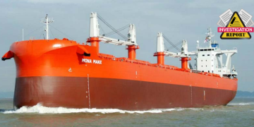
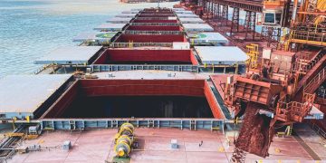
According to Britannia’s recent BSAFE case study, a bulker ran aground while on passage between the Philippines and Australia and provides lessons learned.
The incident
Before the vessel left port, the master requested that the second officer (2/O) alter the original passage plan to make use of the recommendations provided by the owner’s weather routing service. These amendments were made, however, the amended passage plan was presented to the master for his approval, whilst it was incomplete.
As part of the preparations for the vessel’s departure, the 2/O completed the Company’s pre-departure ECDIS settings form, this form noted the following settings:
- Safety depth and safety contour – 20m
- Shallow contour – 15m
- Deep contour – 50m
- Danger detection sector (DDS) – 5.0nm 090 across the bow
- Each leg of the route, which had a default crosstrack limit (XTL) setting of 0.50 nm, had been visually checked.
At 0800, once on passage, the chief officer handed over the watch to the additional second officer (OOW) and left the bridge. Throughout the watch the master, chief officer and 2/O joined the OOW on the bridge at various times to conduct different administrative tasks.
The OOW discussed with the 2/O, who was calculating the next voyage’s bunker requirements, that he was unable to take a line of position from an ECDIS charted feature that appeared ahead, 0.30 nm north of the vessel’s track.
The 2/O replied that the object was a shoal and that he should keep clear of it. The OOW interrogated the feature, however, he did not check whether the depth was safe, in relation to the ship’s draft (4.85m forward and 7.44m aft).
The OOW then began preparing the vessel’s prearrival documents for the next port, as the vessel began to drift gently. This drift to port was not detected by the OOW and at 1155 the vessel crossed the 5.0m depth contour and ran aground.
Following the grounding, the master acted quickly to stop the main engine and reported the incident to the owner, before acting as per the vessel’s emergency response plan, with tank soundings confirming the vessel’s watertight integrity remained intact.
The vessel was then deballasted to allow floating on the rising tide.
Once the vessel had been refloated, it proceeded to port to conduct Class damage surveys, where buckling/deformation of the vessel’s shell plating was observed.
Probable cause
#1 Passage plan
Had the master insisted on reviewing the entire passage plan before departing, he may well have noted that the vessel was due to pass within 0.3 nm of the shoal and that this navigational hazard was not marked as a ‘no go zone’ on the chart. SOLAS Chapter V also states that the voyage plan shall identify a route which: ‘anticipates all known navigational hazards and adverse weather conditions.’ Critical points of the voyage are required to be highlighted within the passage plan and these areas are highlighted during watch handovers. The Safety Management System should contain suitable procedures with regards to passage planning and bridge watch handover procedures. These procedures are expected to be robust and specific to the vessel. Navigational officers should be suitably familiarised with them, and appropriate records maintained of the same.
#2 ECDIS setup
For this voyage, the route check function in ECDIS was not enabled. ECDIS can be operated without certain safety critical functions, such as the route check function, being activated. If the operators are not aware that these functions are inactive, they may expect to be alerted to dangers on the route, which can lead to a false sense of security. The route checking function built into ECDIS to check and monitor a route for dangers is a key safety feature for navigational officers. It provides a vital function in the passage planning stage, ensuring that the route planned is suitable and compliments the visual check of the route. The visual check that was conducted by the OOW in the development of this passage plan was cursory, and did not consider the proximity to the shoal. Had the route check function been activated, it would have highlighted the shoal as it fell within the 0.5 nm safety corridor setup by the OOW.
#3 Bridge distractions
In the lead up to the incident, the OOW was distracted from navigating by calculating the next voyage’s bunker requirements and failed to monitor the progress of the vessel along the planned track. The 2/O warned the OOW that the shoal was ahead and that he should keep clear of it, but the OOW allowed himself to become absorbed in the bunker calculations and ignored the warning. The OOW should have remained focussed on navigating while the vessel approached a known navigational hazard.
#4 Situational awareness
The OOW displayed signs that he lacked situational awareness. He did not know that the charted feature he was trying to take a line of position off was a shoal, and when he interrogated the feature he did not check the depth was safe in relation to the draft of the vessel. The 2/O also warned the OOW that he should keep clear of the shoal. Had the OOW properly checked the depth of the shoal, and appreciated the dangers of navigating within close proximity to shallow water, he would likely not have undertaken non-watchkeeping tasks until the vessel was well clear of navigational hazards.
#5 Emergency preparedness
The report mentions that the master acted quickly and in accordance with the vessel’s emergency response manual following the grounding. It is difficult to establish if the master’s quick actions, such as activating the emergency response procedures and coordinating the response of the crew, contributed to the relatively minor impact of the incident. However, it is encouraging to read that the master and crew were clearly well-versed in their emergency response procedures and were likely well-drilled in their actions, which led to their rapid response to the grounding.


