General cargo ship KARLA C gets allided with the Masnedsund Bridge
Danish Maritime Accident Investigation Board (DMAIB) issued a Marine Accident report regarding the allision of the general cargo ship KARLA C with the Masnedsund Bridge.

On 13 April 2014, the general cargo ship KARLA C allided with the Masnedsund Bridge causing severe damage to the ship and minor damage to the bridge and railway.
KARLA C was one of ten sister ships within the company and it was tramp trading primarily in Northern Europe and the Mediterranean carrying break bulk and regular bulk such as steel and grain. Neither the ship nor the master had called at the Port of Vordingborg before, but this was not considered a significant challenge, because the ship tended to call at smaller ports of a similar size in channels and rivers that are less accessible for other larger ships.
The Masnedsund Bridge that connects the islands of Zealand and Masnedø was built in 1937, is 215 metres long and has a width of 8.8 metres. It is a combined bascule bridge with a single-track railway and a road. It has five supporting pillars and a height between 4 and 5 metres from the water surface to the spans.
On the seabed on the western side of the bridge where the port is situated there are power cables and pipelines for sewage, gas and district heating.
The bridge is usually manned daily, except during the hours of the night unless otherwise agreed with a ship requesting a scheduled passing. Approximately 2,000 ships of varying sizes pass the bridge annually.
In 2002, a risk analysis was made of the scenarios in which a ship might allide with the bridge pillars and/or the steel structure. The analysis concluded that the bascule supporting pillars should be able to withstand the impact of a ship with a range of displacement of 6,400-7,800 t if the bridge pillars were to be considered as belonging in a high safety class. Furthermore, the steel beams between the pillars should be able to withstand the impact of a ship with a range of displacement of 1,500-4,700 t if the steel beams were to be considered as belonging in a high safety class. In the above calculations, a total structural collapse was assumed in 5% of the allision events.
As reference, KARLA C has a winter displacement of 8,641.40 t with a draught of 6.5 metres.
In the channel of Masnedsund, the current changes regularly depending on the weather conditions and can reach up to 3-4 knots. During periods of adverse weather conditions, the current can have the same direction for several days reaching up to 5 knots. On the day of the accident the current near the bridge was estimated to approx. 2.5 knots.
KARLA C suffered considerable damage to the hull on the port quarter, the gangway and the life boat davit. Furthermore, the port side fresh water tank was penetrated and was nearly emptied.
The bridge was struck on the western side where the footpath and road were situated. The railway was on the eastern side. There was damage to the duc dalpe west of the centre pillar and the bridge construction including the footpath, light mast, bridge support structure and railway.
| Analysis and Conclusion |
|
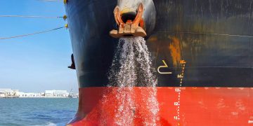
KARLA Cs allision with Masnedsund Bridge was the result of several factors that accumulated into an uncontrollable situation. The decision to approach the berth by the starboard side was deemed to be unproblematic until the ship was in the basin where an alternative approach to the berth was decided due to the unfavourable weather situation and the easterly current. During the approach to the port, there was nothing that indicated to the master or the pilot that the situation was unsafe. The weather situation was within limits of the normal parameters when berthing ships at this particular port. The size of the ship, the length in particular, made it difficult to use the propulsion and rudder to turn the ship as the clearance aft and forward was too small. Therefore, the success of the manoeuvre relied fully on the bow thruster and when it malfunctioned, only the anchors were left to stop the ship from drifting uncontrollably into the bridge. The malfunction of the thruster was caused by a faulty thermistor protection on the thruster motor. With a distance to the bridge of approximately 200-300 metres and an easterly current of 1.5-2.5 knots, there would be only approximately 4-6 minutes before the ship would allide with the bridge. During that time span, the master and pilot were to decide on what action to take in order to avoid the allision or to limit the structural damage if nothing could be done to effectively stop the ship. It was decided to drop the anchors, but there was a small delay in the release of the anchor. Such delays are not uncommon and were in this instance caused by the crewmembers on the forecastle requiring confirmation of the order, as they did not realize that the ship was in an emergency until the master told them. The crewmembers also had to remove the riding chock and release the brake. Once the starboard anchor had been dropped, the port anchor was released without delay. At this point in time, the margins for safe operation were diminished and an allision with the bridge became unavoidable as the ship swung upstream. Any speculation about whether or not the anchors should have been dropped 1 minute earlier is in this context a symptom of the narrow safety margin that exists when large ships are manoeuvring in the vicinity of the Vordingborg Bridge. The accident involving the ship ANMAR-S also describes how a rather simple technical fault can potentially result in severe damage. In this accident the anchors were also instrumental in limiting the consequences. In both cases there were concerns about the cables and pipe lines positioned on the seabed, west of the bridge, that could have been damaged in the attempts the stop the ships. The risk analysis, which was made with the purpose of mapping bridges risk exposure, was based on the assumption that smaller ships would pass the bridge and not operate in the vicinity of the bridge. These accidents indicate that it can be problematic to determine the risk exposure to Masnedsund Bridge by quantitative methods only. |
Further information may be found by reading DMAIB Marine Accident Report by clicking on the image below:
Source and Image Credit: DMAIB


