Saint Vincent and the Grenadines maritime administration issued a circular advising ships of the annexed Resolution MEPC.226(64), adopted 5 October, 2012 designating the Saba Bank as a particularly sensitive area. On 1st June 2013, the Saba Bank area became a Particular Sensitive Sea Area (PSSA), as well as, an Area To Be Avoided (ATBA). As such, ships of 300 GT and above are restricted from this area.
The reefs of the Saba Bank are far removed from land and as a consequence there is an absence of land-based influences such as elevated levels of sedimentation due to increased erosion, high nutrient concentrations caused by pollution from agricultural run-off and wastewater disposal, or sedimentation from coastal construction activities. Worldwide, reefs are in decline, from just such impacts originating from land. This unique position of the Saba Bank reefs, provide a potentially greater resilience to changes in the environmental conditions, such us climate change, and it is a relatively untouched centre for recruitment and recuperation for the coastal reefs in the region.
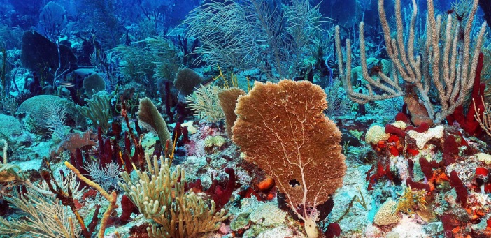
The coral reefs of the Saba Bank, characterized by high coral cover of around 70% in some places, have been determined to be among the four healthiest of the Caribbean, based on the Atlantic and Gulf Rapid Reef Assessment (AGRRA) health index, which is a compilation of many variables, including coral cover, fish populations, presence of diseases, types and cover of algae on the reef, and ratio of living coral versus dead coral.
Because of its location and prevailing currents in the area, the Saba Bank is a source of larval recruitment for corals and coral reef associated organisms, including important fishery species such as conch (Strombus gigas), and lobster (Panulirus argus) for the entire region. The Saba Bank is also a critical habitat for at least two species of sea turtles.
Moreover, the area is formed and sustained by the growth of the corals and coral reefs on it. As such, these organisms provide habitat, food and shelter for all animals and plants living on the Bank. The high diversity of the area is maintained by the numerous feedback mechanisms characteristic for these kinds of ecosystems. As a self-sustaining ecosystem, it is highly productive and also forms an attractive feeding and nursery ground for many migratory species.
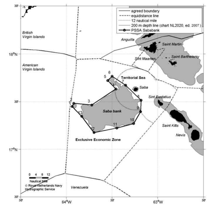
In order to avoid the risk of pollution and damage to this unique, fragile and pristine coral reef ecosystem, and the risks to the artisanal fisheries of the area, mariners should exercise extreme care when navigating in the area bounded by a line connecting the following geographical position, which is designated as a Particularly Sensitive Sea Area. The area to be avoided by ships of 300 GT and above and a mandatory no anchoring area for all ships is bounded by a line connecting the following geographical positions:
- 17° 27′.06 N 063° 56′.14 W
- 17° 29′.00 N 063° 55′.09 W
- 17° 27′.94 N 063° 43′.32 W
- 17° 38′.03 N 063° 27′.41 W
- 17° 43′.35 N 063° 32′.74 W
- 17° 45′.98 N 063° 29′.98 W
- 17° 40′.34 N 063° 21′.10 W
- 17° 30′.88 N 063° 10′.92 W
- 17° 23′.80 N 063° 11′.25 W
- 17° 16′.27 N 063° 15′.85 W
- 17° 13′.44 N 063° 26′.89 W
- 17° 10′.55 N 063° 41′.81 W
- 17° 20′.85 N 063° 49′.89 W
Defiance of this circular will result in financial implications/charges being imposed by the Dutch Caribbean Coast Guard.


