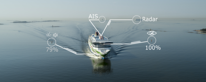
The Finnish Geospatial Research Institute and Aalto University will cooperate with maritime solution providers Fleetrange and Tallink Grupp on a project to develop autonomous shipping. Mainly, the project’s goal is to create a system that automatically identifies and recognizes objects, such as navigation aids and other vessels around the ship, improving situational awareness.
Specifically, the technology will provide data from visual images, environmental sound recordings and satellite navigation, as well as systems such as RADAR and LiDAR ranging. The goal of the joint-venture is to develop techniques for safe navigation using a combination of different sensors, machine learning tools and artificial intelligence (AI).
[smlsubform prepend=”GET THE SAFETY4SEA IN YOUR INBOX!” showname=false emailtxt=”” emailholder=”Enter your email address” showsubmit=true submittxt=”Submit” jsthanks=false thankyou=”Thank you for subscribing to our mailing list”]
According to NLS, these sensors will be installed on the Megastar and the data processing will be performed using innovative artificial intelligence and machine learning software.
Dr. Sarang Thombre, Research Manager at the Finnish Geospatial Research Institute noted that only one sensor is not sufficient enough to provide complete safety information to the crew.
An autonomous navigation system should have multiple devices that will provide information, he continued.
If this kind of information is combined with the vessel navigation rules and regulations, it will be possible to navigate the vessel with minimum human guidance.
Also, Dr. Simo Särkkä, Professor of Aalto University commented that
The recent advances in artificial intelligence and machine learning allow for new ways to learn to identify and predict the movement of vessels, with a better accuracy that has been possible before.
Concluding, the project is funded by the European Space Agency (ESA).


