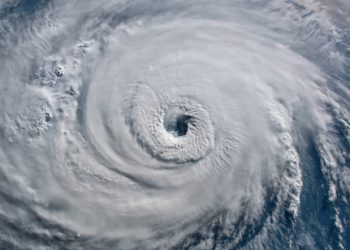
Hurricane Matthew will not be an obstacle to TOTE ships as they plan to continue their cargo schedule and not postpone it despite warnings. Matthew is one of the most powerful Atlantic hurricanes in recent history and is forecast nearing the western tip of Haiti.
Last October, El Faro owned by TOTE Maritime sank during Hurricane Joaquin, killing 33 crew members, however, company officials are not planning to stop business along their Jacksonville to Puerto Rico route. The ship that replaced the El Faro is the Isla Bella, considered one of the best in the market.Its a new ship that is run by natural gas.
According to ABC news, Tuesday, a TOTE ship will leave Jacksonville for Puerto Rico and another will leave San Jaun for Jacksonville.
First Coast News Meteorologist Tim Deagan says this week, the water along the cargo shipping route can get as high as 40 feet.
“I cannot imagine a more serious situation. This hurricane is more intense than Joaquin. It is larger than Joaquin.”
ABC spoke to TOTE officials about if they plan to make any changes. They sent a list of questions and they got as a response only the following:
“Our crews are trained to deal with unfolding weather situations and are prepared to respond to emerging situations while at sea. TOTE Services has great confidence in its highly experienced officers.”
The ship is scheduled to depart Jacksonville at midnight and it will also be when Hurricane Mathew is projected to be closest to the First Coast.
5 things you need to know about Hurricane Matthew
1. Hurricane Matthew is expected to hug the coast and move to the north, so this means Tropical storm or Hurricane watches are possible for the First Coast.
2. Since it’s only Tuesday, we still have time to watch the storm. Now is not the time to panic, however families should communicate regularly and get their hurricane kits ready — just in case
3. Hurricane Matthew has winds of 145 mph and the National Hurricane Center says it’s strengthening each day, we’ll watch the storm closely as it continues to move north.
4. By Friday Hurricane Matthew should be scooting along coast by 90 miles, that will be the day we see most of the impacts. Hurricane Center does have this storm brushing the Carolinas and making landfall.
5. First Coast should see the biggest impacts Thursday night into Friday with wind speeds up to 45+ mph. This means we’ll get heavy rains, flood threats and dangerous surf.
Source: ABC – Firstcoastnews.com























INTERNATIONAL CONVENTION FOR THE SAFETY OF LIFE AT SEA Chapter V, regulation 34 “Safe navigation and avoidance of dangerous situations”.