Tag: navigation

Filter By:

Filter

Polar shipping guide launched by The Nautical Institute

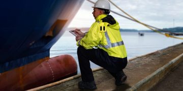
Guide aimed at seafarers, shipowners and others who are planning to operate in that extreme environm There has been an increase in activity in the polar regions as the maritime and offshore industries respond to global warming and the need to find more sources of energy. However, as author Captain Duke Snider FNI explains, these regions used to be the domain of experienced operators and vessel owners.Captain Snider says: "As global climate change has resulted in an increase interest in shipping in Polar Regions, such a reference gap is of paramount importance. Polar Ship Operations addresses this gap in reference material."The book is laid out to familiarise readers with the geographic, climatological and meteorological aspects of the Arctic and Antarctic, to explain the remoteness of these regions and the lack of support infrastructure. Other chapters cover the physics of ice formation and basics of ice interpretation and reporting, offering help to identify old and glacial ice, the preparation for operating in these regimes and ship handing in polar ice conditions.The book was launched at the 8th annual Arctic Shipping Forum held by Informa in Helsinki, less than two weeks after a report on the development of the Arctic from Lloyd's ...

Read more

Breaking the Ice on Icebergs

Q&A re icebergs Icebergs are a natural and beautiful part of Earth's cryosphere, and are closely monitored and studied by scientists around the world. We asked JPL research scientists Ben Holt and Michael Schodlok to attempt to remove some of the mystery shrouding these floating flotillas of ice.Q. What are icebergs and how are they formed?A. Ben Holt: Icebergs form from the natural calving of glaciers and Earth's great ice sheets, which extend into the ocean. These ice extensions, called tongues and shelves, lose strength as they extend further from their attachments to land, eventually breaking off in a process called 'calving' to form icebergs.Q. How do icebergs move?A. Ben Holt: Once they form, icebergs are moved by winds and currents, drifting either north or south toward Earth's equator, where they eventually melt. They may get stuck locally by the ocean bottom or even by surrounding sea ice.Q. Where do icebergs form, and how big can they get?A. Ben Holt: Earth's largest icebergs are formed from the extensive ice shelves in Antarctica-giant, so-called "tabular" icebergs. In the Arctic region, Greenland glaciers are the primary source, generally forming considerably smaller icebergs than those found in Antarctica. These smaller icebergs, sometimes called ...

Read more

E-Navigation is alive and well

The framework is no longer called by EfficienSea, but ACCSEAS The Danish Maritime Authority is still in the lead of the development of the navigation concept of the future, e-Navigation. Now, the framework is no longer called by EfficienSea, but ACCSEAS. With the conclusion of the EfficienSea project in early 2012, one could fear that the work on e-Navigation would become homeless. But fortunately that is not the case. In April 2012, a new EU project was born, ACCSEAS, and within this framework the work on e-Navigation will be continued. The project covers the North Sea and consists of 11 partners from Denmark, Sweden, Norway, Germany, the Netherlands and the United Kingdom. The Danish Maritime Authority is among the ones in the forefront of two work packages concerning the development of new services and tests and user feedback."We are not starting all over again, but drawing on the experiences gained so far, just as we are refining and further developing the equipment already installed in the form of platforms, software, etc. We will also continue with some of the same test users, so much of the fundamental work has already been done", stresses Thomas Christensen, e-Navigation Project Manager.Two e-Navigation legs"In ...

Read more

Taking ECDIS very seriously

As with all electronic equipment, ECDIS can go wrong In little more than three months we will see the carriage requirements for the Electronic Chart Display and Information System (ECDIS) begin its phased introduction. ECDIS is a notable advance to be welcomed by all of those who believe that eNavigation is a step in the right direction, making navigation yet more precise.But like all navigational advances from the introduction of the gyro-compass to satnav and advanced radars, the latest improvement comes with a number of important "health warnings". As with all these advances, complete reliance is to be avoided and the practices of good seamanship, which insist on alternative systems for checking, must still be followed assiduously. Training is clearly essential, both in terms of the generic understanding of the systems and complete familiarity with that aboard ship.As with all electronic equipment, ECDIS can go wrong and too much reliance will lead to a complacent attitude that is unprepared for the (hopefully rare) incident. Pilots are already reporting occasional instances of ECDIS errors and anomalies, which may be difficult to detect in the open sea but become much more obvious with the ship in restricted waters and the scale of ...

Read more

Top 10 facts about the International Ice Patrol

Are icebergs really still a danger? 1. When was the International Ice Patrol formed?Shipping areas in the North Atlantic have always been hazardous to navigate. The hazards of the North Atlantic captured global attention in April 1912 when the RMS Titanic sank after it struck an iceberg. The incident prompted maritime nations with ships transiting the Grand Banks off Newfoundland, Canada, to establish an iceberg patrol in the area. Since 1913, the U.S. Coast Guard has been tasked with the management and operation of the patrol. Except for the years of World Wars I and II, the ice patrol has been active each ice season since its inception.2. What are the specific duties of the ice patrol?Their mission is to monitor the iceberg danger near the Grand Banks of Newfoundland and provide the iceberg limit to the maritime community, including ice and current conditions.3. Who makes up the ice patrol?The ice patrol is a U.S. Coast Guard unit however the Canadian Ice Service, ice patrol and U.S. National Ice Center collaborate under the North American Ice Service. The ice patrol produces North American Ice service reports from February through July when icebergs may be present on the Grand Banks and ...

Read more

UKHO adds Vietnam Electronic Navigational Charts

Providing greater navigational detail The United Kingdom Hydrographic Office (UKHO) has announced new ENC (Electronic Navigational Chart) coverage in Vietnam, providing greater navigational detail for the region.The three new ENCs cover the ports and approaches to Vung Tau, which includes the main container port of Cai Mep, and are only available through the Admiralty Vector Chart Service.UKHO says that the new ENCs have been produced in response to increasing demand from shipping companies for chart data for the region."Vietnam continues to outperform many economies around the world. Increased shipping trade plays a key role in maintaining that growth so fully compliant digital coverage of this area is an important addition for many shipping companies," said Guy Edwards, head of Admiralty Asia Pacific, Singapore."We worked closely with our colleagues in the Vietnam Maritime Safety Authority to produce these ENCs to cover the key hub of Vung Tau and container port of Cai Mep, which represent a major gateway to trade in southern Vietnam."The Admiralty Vector Chart Service contains over 11,500 ENCs and coverage of over 2,950 of the world's ports.Source: UKHO

Read more

Modernization of distress and safety communication at sea

IMO Sub-Committee on Radiocommunications and Search and Rescue United Nations' International Maritime Organization (IMO) held a meeting in the Sub-Committee on Radiocommunications and Search and Rescue (COMSAR 16). The meeting was held at the IMO headquarters in London on 12-16 March 2012.The meeting focused especially on the work revising and modernizing the GMDSS system, which stipulates regulations and standards for maritime distress and safety communication. The GMDSS system has been operative for about 20 years, and technological developments have meant that, at the COMSAR session held in 2010, it was decided to start pre-investigating the need for modernizations. During the pre-investigations, a revision and modernization of the system was considered necessary, which there was also general agreement about at the COMSAR session just held.Consequently, a work plan for a revision and modernization of the GMDSS system was agreed upon, and this work is planned to be finalized in 2017. Furthermore, it was decided to re-establish a correspondence group, which is to continue the ongoing work until the next COMSAR session that will be held in 2013.A joint working group at the IMO and the International Telecommunication Union (ITU) will, in addition, consider the revision of the GMDSS system at a ...

Read more

Only one in three ECDIS functions as expected

According to the International Hydrographic Bureau The International Hydrographic Bureau (IHB) has issued a circular with updated information on the results of an ENC Data Presentation and Performance Check initiated in October 2011 to examine the performance of ECDIS systems, which notes that only one-third of the manufacturers' systems reported were functioning as expected.According to the circular, by the end of February the IHB had received nearly 500 reports from sea, covering 15 out of approximately 25 recognised manufacturers of type-approved ECDIS. It notes that the 15 manufacturers represent "by far the most popular brands of ECDIS being used at sea today."Out of these ECDIS installations it is noted that "about a third of the manufacturers' systems reported to the IHB appear to function as expected in the checks.""A further third of the systems display all significant underwater features, including underwater obstructions, but the isolated danger symbol required to be shown under certain conditions is not always used."It continues: "This issue is unlikely to have a significant impact on safe navigation. Most of the remaining third of the systems reported to the IHB failed to display some significant underwater features in the 'Standard' display mode.""Under various conditions, mostly related to ...

Read more

ECDIS a time of navigational change

Ships' officers must be familiar with the particular equipment There is a great deal for operators to take on board with the arrival of the Electronic Chart Display and Information System (ECDIS) which is such an integral part of the "e-navigation" world of the future. There is, of course, the requirement for people to be trained to use the equipment, and not just in generic terms. Ships' officers must be familiar with the particular equipment that is fitted to the ship they are serving aboard.This itself introduces complications when appointing people to serve on ships in a fleet where different types of navigation equipment are fitted, even after they have received their generic training in ECDIS. Once flexible people who could serve in their rank in any unit of the fleet at a moment's notice, officers will now have to be appointed on the basis of their familiarity with the equipment fitted to their prospective ship. It is a complication that personnel people could probably do without. If officers do not have this "type-training" behind them, they will have to serve in an "auxiliary" role until they have completed it - another complexity, before they are permitted to use the ...

Read more

Safemed II hosts workshop in Lisbon

Long-range identification and tracking of ships The EU-funded Safemed II project is organising a workshop on the Long-Range Identification and Tracking of Ships (LRIT) at the European Maritime Safety Agency (EMSA) premises in Lisbon, Portugal, between 19 and 20 March 2012.The main objectives of this workshop are to familiarise the participants with LRIT requirements, both legally (International Maritime Organisation Rules & Regulations) and also technically; with the roles of the International Mobile Satellite Organization (IMSO), Long-Range Identification and Tracking International Data Exchange (LRIT-IDE) Operator, LRIT Data Centres (DC) and other Application Service Providers (ASP).It will seek to provide the participants with an overview of the operational and technical activities required operating and maintaining a Data Centre at required standard of performance, and exchange views on the experiences gained so far on the LRIT.The 5.5 million SafeMed II project seeks to mitigate the existing imbalance between the participating partners that are EU Mediterranean member states and the non EU members from the region in the application of maritime legislation. Among its activities, it funds scholarships to internationally recognized maritime universitiesSource: SafeMed

Read more
Page 37 of 41 1 36 37 38 41