EMSA operates CleanSeaNet, a satellite-based oil spill surveillance and vessel detection service.
The service is available to all EU Member States, EFTA/EEA Member States and acceding and candidate countries. Territorial waters of coastal Member States, and overseas countries and territories may also be monitored.
The CleanSeaNet service analyses Synthetic Aperture Radar (SAR) images from Earth Observation satellites to detect possible oil spills on the sea surface. When a spill is detected, a pollution alert is sent to national authorities. The alerts are available within 30 minutes of the satellite acquiring the image. The national authority then decides how to respond to the alert from CleanSeaNet. A patrol aircraft or vessel may be sent to survey the area and verify the oil spill detection. The vessels detected by satellite in the vicinity of the oil spill may be correlated with vessel traffic reports to increase the likelihood of identifying the probable source of the spill.
CleanSeaNet can also provide access to some additional services including very high resolution optical satellite images, wind speed and direction at the time and place of the image acquisition, as well as meteorological and oceanographic data.
Catching polluters
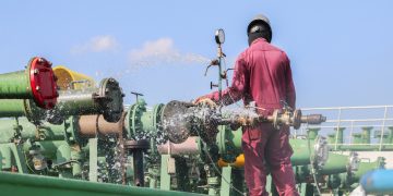
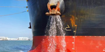
Ships may produce oily waste from leaks and maintenance work, purification of fuel oil and, in the case of oil bunkers, cleaning their tanks. There are strict regulations about how this oily waste can be disposed of, whether in port facilities by incineration, or discharged into the sea at very low concentrations. Not disposing of the waste this way is illegal.
Offshore platform monitoring
 EMSA may be asked by Member States to monitor possible spills caused by offshore installations. This service can cover both routine monitoring for operational spills, and emergency monitoring for large-scale pollution incidents.
Emergency response
In case of a major accidental oil spill at sea, EMSA supports coastal states by providing satellite images to monitor the spill location over an extended period for response and recovery operations.
How does it work?

Radar sensors measure the roughness of the sea surface. Some substances, for example oil, smooth the sea surface reducing the level of the signal returned to the radar emitter. The radar signal is processed into an image in which oil spills appear as dark areas, and vessels and other offshore structures, including oil and gas platforms, appear as bright spots.
Low and high wind conditions, and other natural phenomenon, can have the same effect as oil spills on the image. The images are therefore analysed by experienced on-duty operators
|
CleanSeaNet in action
A satellite image has been used as primary evidence in a maritime pollution court decision. A CleanSeaNet satellite image detected a vessel on 25 February 2012 discharging oil in the waters between Land’s End and the Scilly Isles. A pollution alert was sent to the UK Maritime and Coastguard Agency and the Falmouth Coastguard contacted the vessel to enquire about the spill.
The master reported that the tanker had been discharging palm oil but had stopped at 13.5 nautical miles from the coast. However, the CleanSeaNet image and alert report clearly showed that the discharge had continued within the 12 nm limit and was therefore illegal. As a consequence, the owner was found guilty and fined.
Source and Image Credit: EMSA
In the starting, I was outspoken with you propecia before and after has changed my life. It has become much more fun, and now I have to run. Just as it is fabulous to sit.


