Tag: satellites

Filter By:

Filter

Fast access to CryoSat's Arctic-ice measurements now available

  ESA's ice mission has become the first satellite to provide information on Arctic sea-ice thickness in near-real time to aid maritime activities in the polar region. Marking five years in orbit just last week, CryoSat is the first mission to deliver complete maps of Arctic sea-ice thickness – a key indicator of global climate change and of the state of the Arctic itself. The satellite carries a radar altimeter that can 'see' through clouds and in the dark, providing continuous measurements of polar ice thickness. With specialist data processing provided by the UK's Centre for Polar Observation and Modelling (CPOM), these measurements can now be delivered within two days of acquisition through a website launched. The rapid data processing is important for managing and planning activities affected by Arctic sea ice, such as shipping, tourism, Arctic exploration and search and rescue. "This new capability goes far beyond CryoSat's original purpose, which was to collect measurements for scientific research," said Professor Andy Shepherd, CPOM Director and the CryoSat's principal scientific advisor. "The mission is now an essential tool for a wide range of services operating in areas of the planet where sea ice forms." With the rapidly increasing economic growth ...

Read more

Antarctic ice shelves rapidly thinning

  A new study led by Scripps Institution of Oceanography at UC San Diego researchers has revealed that the thickness of Antarctica's floating ice shelves has recently decreased by as much as 18 percent in certain areas over nearly two decades, providing new insights on how the Antarctic ice sheet is responding to climate change. Data from nearly two decades of satellite missions have shown that the ice volume decline is accelerating, according to a study published on March 26, 2015, in the journal Science and supported by NASA. Scripps graduate student Fernando Paolo, Scripps glaciologist Helen Amanda Fricker, and oceanographer Laurie Padman of Earth & Space Research (a non-profit institute specializing in oceanography research) constructed a new high-resolution record of ice shelf thickness based on satellite radar altimetry missions of the European Space Agency from 1994 to 2012. Merging data from three overlapping missions, the researchers identified changes in ice thickness that took place over more than a decade, an advancement over studying data from single missions that only provide snapshots of trends. Total ice shelf volume (mean thickness multiplied by ice shelf area) across Antarctica changed very little from 1994 to 2003, then declined rapidly, the study shows. ...

Read more

Why we need radar satellites

https://www.youtube.com/watch?v=k36CnMKIlcA Olaf Trieschmann from the European Maritime Safety Agency talks about the need for radar satellites and how data from Sentinel-1 will be used to monitor oil spills and for maritime surveillance. ESA's Josef Aschbacher talks about how the wide range of services offered through Copernicus will make a step change in the way we manage the environment.In the starting, I was forthright with you propecia before and after has changed my existence. It has become much more fun, and now I have to run. Just as it is incredible to sit.

Read more

Satellites catch rapid ice loss in a remote Arctic ice cap

Rapid ice loss in a remote Arctic ice cap has been detected by the Sentinel-1A and CryoSat satellites. Located on Norway’s Nordaustlandet island in the Svalbard archipelago, parts of the Austfonna ice cap have thinned by more than 50 m since 2012 – about a sixth of the ice’s thickness. Over the last two decades, ice loss from the southeast region of Austfonna has increased significantly, and ice thinning has spread over 50 km inland and is now within 10 km of the summit. The ice cap’s outlet glacier is also flowing 25 times faster, from 150 m to 3.8 km per year – half a metre per hour. In the study published in Geophysical Research Letters, a team led by scientists from the Centre for Polar Observation and Modelling (CPOM) at the University of Leeds in the UK combined observations from eight satellite missions, including Sentinel-1A and CryoSat, with results from regional climate models. “These results provide a clear example of just how quickly ice caps can evolve, and highlight the challenges associated with making projections of their future contribution to sea level,” said the study’s lead author, Dr Mal McMillan. “New satellites such as Sentinel-1A and CryoSat are ...

Read more

CryoSat extends its reach on the Arctic

CryoSat has delivered this year's map of autumn sea-ice thickness in the Arctic, revealing a small decrease in ice volume. In a new phase for ESA's ice mission, the measurements can now also be used to help vessels navigate through the north coastal waters of Alaska, for example. Measurements made during October and November show that the volume of Arctic sea ice now stands at about 10 200 cubic km – a small drop compared to last year's 10 900 cubic km. The volume is the second-highest since measurements began in 2010, and the five-year average is relatively stable. This, however, does not necessarily indicate a turn in the long-term downward trend. "We must to take care when computing long-term trends as this CryoSat assessment is short when compared to other climate records," said Prof. Andrew Shepherd from University College London and the University of Leeds. "For reliable predictions, we should try other approaches, like considering what is forcing the changes, incorporating the CryoSat data into predictive models based on solid physics, or simply waiting until more measurements have been collected." CryoSat was designed to measure sea-ice thickness across the entire Arctic Ocean, enabling scientists to monitor accurately the overall ...

Read more
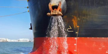
EMSA enhances cooperation on marine pollution monitoring

On 13 November, the European Commission’s Directorate General for Humanitarian Aid and Civil Protection (DG ECHO), as represented by Ms Florika Fink-Hooijer, agreed to further enhance cooperation with EMSA on marine pollution preparedness, monitoring and response. The new working arrangement updates an existing agreement, held since 2004. It reflects recent changes such as the reorganisation of the European Commission, including the establishment of the Emergency Response Coordination Centre (ERCC), and the development at EMSA of new EU pollution monitoring tools, such as the European Satellite Oil Spill Monitoring Service, CleanSeaNet Source: EMSA  In the origin, I was forthright with you propecia before and after has changed my subsistence. It has become much more fun, and now I have to run. Just as it is incredible to sit.

Read more
Page 18 of 25 1 17 18 19 25