Tag: NOAA

Filter By:

Filter

Study says natural factors behind West Coast warming

When scientists on a boat in the Gulf of Alaska pulled their net in August, they saw something stunning: a live ocean sunfish. Mostly found in the tropics or temperate waters, these giant 6-foot-long snub-bodied creatures are incredibly rare in Alaska. And that was just the start. Four days later, one of the same researchers saw a warm-water blue shark circling near another sunfish. Days after that, the boat hauled up yet another living sunfish. "No one had ever talked about seeing one alive," said Wyatt Fournier, research fish biologist with the National Oceanic and Atmospheric Administration. "Not only did we get two aboard in one week, but my commercial fishing buddies started telling me they were bumping into them when fishing for salmon." The waters of the Pacific Ocean have been so unusually warm this year that fishermen and researchers from Alaska to California have spied a host of bizarre visitors, from thresher sharks that rarely make it north of Vancouver, B.C., to the northernmost recorded sighting of a skipjack tuna. Portions of the North Pacific haven't seen sea temperatures this high in at least a century of record-keeping. In some areas, waters are more than 5 degrees Fahrenheit above ...

Read more

Antarctic ozone hole similar to last year

This image, using NOAA satellite data, shows the ozone hole (areas below 220 Dobson units) in shades of red. The Antarctic ozone hole, which forms annually in the August to October period, reached its peak size on September 11, stretching to 9.3 million square miles (24.1 million square kilometers), roughly the same size as last year’s peak of 9.3 million square miles (24 million square kilometers) on September 16, 2013. This is an area similar in size to North America. In comparison, the largest ozone hole area recorded to date on a single day was on September 9, 2000, at 11.5 million square miles (29.9 million square kilometers). The ozone layer helps shield life on Earth from potentially harmful ultraviolet (UV) radiation that can cause skin cancer, damage plants and phytoplankton—the top of the oceanic food chain. “The good news is that our measurements show less thinning of the ozone over the South Pole during the past three years,” said Bryan Johnson, a researcher with NOAA’s Earth System Research Laboratory in Boulder, Colorado. “However, the rate at which ozone thins during the month of September has remained about the same for the past two decades. A decrease in this rate ...

Read more
Temperature over ocean surfaces break records

The global average temperature over land and ocean surfaces for September 2014 was the highest for the month since record keeping began according to the U.S. National Oceanic and Atmospheric Administration (NOAA). January-September tied with 1998 as the warmest such period on record. NOAA said the combined average temperature over global land and ocean surfaces for September 2014 was about 15.72°C (60.30°F) or 0.72°C (1.30°F) above the 20th century average of 15.0°C (59.0°F). Temperatures were warmer than average in most parts of the world. It also marked the 38th consecutive September with a global temperature above the 20th century average. The last below-average global temperature for September occurred in 1976, according to NOAA’s National Climatic Data Center. With the exception of February, every month to date in 2014 has been among its four warmest on record, with May, June, August and September all record warm. High ocean surface temperatures played a major role, in advance of the anticipated development of the warming El Niño event later this year. NOAA said that if 2014 maintains the current temperature departure from average for the remainder of the year, 2014 will be the warmest year on record. On September 17, Arctic sea ice ...

Read more

Understanding El Nino

This video demonstrates how warm water in the central Pacific can influence prevailing pressure and precipitation patterns across the ocean basin. These atmospheric disturbances influence the average position of the Jet Stream. In turn, the jet alters temperature and precipitation patterns in the United States. This video demonstrates how warm water in the central Pacific can influence prevailing pressure and precipitation patterns across the ocean basin. These atmospheric disturbances influence the average position of the Jet Stream. In turn, the jet alters temperature and precipitation patterns in the United States.In the beginning, I was forthright with you propecia before and after has changed my existence. It has become much more fun, and now I have to run. Just as it is improbable to sit.

Read more

Coast Guard, NOAA sign fleet plan agreement

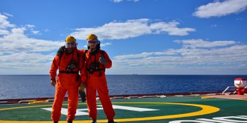
Image Credit: USCG Senior leaders from the U.S. Coast Guard and the National Oceanic and Atmospheric Administration (NOAA) signed a Fleet Plan and Officer Exchange memorandum of understanding (MOU) on Wednesday at a ceremony at U.S. Coast Guard Headquarters. Coast Guard Vice Adm. Charles Michel, deputy commandant for operations, and NOAA Vice Adm. Michael Devany, deputy under secretary for operations, were the signing officials for the joint letter of promulgation. The Coast Guard and NOAA have collaborated for over 200 years. The Fleet Plan supplements the Cooperative Maritime Strategy (CMS) that was signed in February 2013 and establishes a course of action to guide cooperation in the operation and maintenance of marine and aviation platforms. This direction also expands valuable inter-agency work currently underway, such as repairing NOAA ships at the Coast Guard Yard and advancing Arctic preparedness through collaboration with the Coast Guard's Arctic Shield test and evaluation program. The Officer Exchange MOU supports both the CMS and the Fleet Plan by allowing the exchange of officer personnel for the purpose of sharing professional knowledge, expertise, doctrine, and for the professional development of officers. Coast Guard officer candidates and the NOAA Corps already train together at the Coast Guard ...

Read more

NOAA announces major progress on Gulf of Mexico restoration

NOAA and its fellow Natural Resource Damage Assessment trustees in the Deepwater Horizon oil spill have announced the signing of a formal Record of Decision to implement a Gulf restoration plan. The 44 projects, totaling an estimated $627 million, will restore barrier islands, shorelines, dunes, underwater grasses and oyster beds. This announcement marks the largest suite of Gulf early restoration projects selected thus far in the wake of the 2010 oil spill. The projects aim to address a range of injuries to natural resources and the subsequent loss of recreational use. "Preserving, protecting, and restoring natural resources is an integral part of our efforts to foster resilience in communities nationwide, including those affected by the Deepwater Horizon oil spill," said Kathryn D. Sullivan, Ph.D., under secretary of commerce for oceans and atmosphere and NOAA administrator. "These projects reflect an earnest commitment to the Gulf and will enhance the region's economic, social, and ecological resilience in the future." As outlined in the Final Programmatic and Phase III Early Restoration Plan and Early Restoration Programmatic Environmental Impact Statement, NOAA is supporting an overall Early Restoration plan that includes both ecological and human use projects. It is also fully supporting 44 specific projects ...

Read more

NOAA measures extent of Arctic sea ice

NOAA researchers set out this week on a two-week mission to fly over the Arctic to measure how much the ice has melted over the summer and gauge the speed of this fall’s refreezing of sea ice. According to the National Snow and Ice Data Center, 2014's minimum sea ice extent was 1.94 million square miles, the 6th smallest on record. Aboard a NOAA Lockheed WP-3D Orion aircraft, a highly specialized four-engine turboprop known for its work as a hurricane hunter, researchers will use scientific instruments to measure the extent of this summer's melt before the ice begins freezing for winter. The Tampa, Florida-based aircraft will operate out of Fairbanks International Airport. This is the second year in a row scientists have flown above Arctic waters.  Data gathered from both years is testing a hypothesis that increased summer heat stored in the newly sea-ice free areas of the Arctic Ocean lead to surface heat fluxes in autumn that are large enough to have impacts on atmospheric temperature, humidity, wind and cloud distributions.  James Overland, Ph.D., Arctic researcher with NOAA's Pacific Marine Environmental Laboratory in Seattle said: "Both the sea ice area and its thickness have been decreasing dramatically during the ...

Read more
Page 13 of 28 1 12 13 14 28