Tag: NOAA

Filter By:

Filter

Saildrones explore the Bering Sea

  On April 22, two autonomous surface vehicles equipped with meteorological and oceanographic sensors will be released for the first time in the Bering Sea by NOAA’s Office of Oceanic and Atmospheric Research Pacific Marine Environmental Laboratory (PMEL). Saildrones have the capacity to increase observational infrastructure in remote and hostile polar regions where ship time and human labor is costly and potentially hazardous. The ongoing development of Saildrones is a collaborative effort of researchers at PMEL, the Joint Institute for the Study of Atmosphere and Ocean (JISAO) at the University of Washington, the University of Alaska Fairbanks, and Saildrone Inc. The wind- and solar-powered Saildrone incorporates the principles of sailing and scientific research with a nearly 20 foot high carbon-fiber wing that speeds through the waters with a suite of high resolution sensors. Compared to other remotely operated vehicles, these autonomous surface vehicles can carry over 200 pounds of instrumentation, travel at speeds up to 16 mph, and are quickly maneuverable. There is also no need to ‘drive’ or continuously monitor Saildrones. Like a ship with a set course, a Saildrone will continue on its path while continuously taking measurements, notifying on-call engineers of potential dangers via phone. For the past ...

Read more

Five years after Deepwater Horizon

A chromatogram of oil that leaked from the Macondo well. Each peak represents one of thousands of chemical compounds in the oil (Image Credit: Woods Hole Oceanographic Institution) Five years after the Deepwater Horizon oil rig exploded, killed 11 workers, and unleashed the largest accidental oil spill in history, the lingering question five years on is how long will it take the environment to get back to “normal.” What’s normal for the Gulf, however, is an elusive question for scientists. One of the most deviling issues is where vast amounts of the 4.9 million barrels of oil still unaccounted for and 1.85 million gallons of the toxic oil dispersant Corexit that sunk it went, and to what extent this combination is still affecting the seas, marshes, beaches and wildlife. The oil still at large, said a 2014 study from the University of California at Santa Barbara, the Woods Hole Oceanographic Institute and the University of California at Irvine, is estimated at about 2 million barrels, which is on the ocean floor at depths of some 1000 meters. Scientists generally estimate it will take another five to 10 years from now to determine the full impact of the spill from BP’s ...

Read more
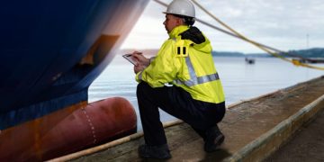
Deepwater Horizon oil spill recovery leaders united to restore the Gulf

Five years after the nation’s largest off-shore oil spill, the leaders of three aspects of the Deepwater Horizon oil spill recovery effort, including the Gulf Coast Ecosystem Restoration Council (Council), the Natural Resource Damage Assessment (NRDA) Trustees, and the National Fish and Wildlife Foundation (NFWF), expressed continued commitment to ensure the Gulf of Mexico fully recovers from this disaster. Although involved in separate processes with different responsibilities, the leaders of these efforts emphasize they are coordinating with one another to ensure efforts fit together for the benefit of the Gulf environment and the people affected by the spill. “Five years after the devastating Deepwater Horizon oil spill, the Council’s mission remains critical to restoring the ecosystem and economy for the people who live, work and play in the Gulf region,” said U.S. Secretary of Commerce Penny Pritzker, Chairperson of the Gulf Restoration Council. “We will continue doing everything we can in coordination with our partners and stakeholders in the region to make sure the Gulf Coast comes back stronger and more vibrant than before the disaster.” The Council expects to publish an initial draft funded priorities list for public comment and then select projects for funding later this year. “We ...

Read more

NOAA plans increased 2015 Arctic nautical charting operations

NOAA officers aboard one of the smaller survey vessels contemplate the vastness of the Chukchi Sea during the NOAA Ship Fairweather's reconnaissance survey in 2013. As commercial shipping traffic increases in the Arctic, NOAA is taking major steps to update nautical charts in the region. NOAA’s Office of Coast Survey will use data collected by two of its own ships, Rainier and Fairweather, as well as the U.S. Coast Guard cutter Healy and a private sector hydrographic contractor to cover nearly 12,000 nautical miles in the Arctic  for use in updating its navigational charts. The NOAA-led Arctic marine corridor project will work with the Coast Guard to asses the safety of a potential Arctic shipping route from Unimak Island, the largest of the Aleutian Islands, through the Bering Strait to the Chukchi Sea, as proposed in the USCG Port Access Route Study for the region. The Coast Guard will continue to take public comments prior to making a final decision on the proposed route. Much of our charting data in this corridor is from surveys conducted a hundred years ago,” said Rear Admiral Gerd Glang, director of NOAA’s Office of Coast Survey. So right now, we need to conduct reconnaissance of ...

Read more

Arctic Report Card 2014

Arctic Report Card for 2014 gets issued, tracking recent environmental changes, with 10 essays prepared by an international team of 63 scientists from 13 different countries and an independent peer-review organized by the Arctic Monitoring and Assessment Programme of the Arctic CouncilIn the starting, I was outspoken with you propecia before and after has changed my subsistence. It has become much more fun, and now I have to run. Just as it is improbable to sit.

Read more

Arctic is warming at twice the rate of anywhere else on Earth

A new NOAA-led report shows that Arctic air temperatures continue to rise at more than twice the rate of global air temperatures, a phenomenon known as Arctic amplification. Increasing air and sea surface temperatures, declining reflectivity at the surface of the Greenland ice sheet, shrinking spring snow cover on land and summer ice on the ocean, and declining populations and health of some polar bear populations are among the observations released today in the Arctic Report Card 2014. “Arctic warming is setting off changes that affect people and the environment in this fragile region, and has broader effects beyond the Arctic on global security, trade, and climate,” Craig McLean, acting assistant administrator for the NOAA Office of Oceanic and Atmospheric Research, said during a press conference today at the annual American Geophysical Union Fall Meeting in San Francisco. “This year’s Arctic Report Card shows the importance of international collaboration on long-term observing programs that can provide vital information to inform decisions by citizens, policymakers and industry.” McLean joined other scientists to release the Arctic Report Card, an annual update provided since 2006, that summarizes changing conditions in the Arctic. Some 63 authors from 13 countries, United States and other nation’s federal agencies ...

Read more

NOAA and British Geological Survey update World Magnetic Model

NOAA officials announced that the World Magnetic Model (WMM), a representation of Earth’s large-scale magnetic field and an indispensable complement to GPS devices used by NATO, the United States and United Kingdom militaries, as well as civil applications ranging from mineral exploration to smartphone apps, has been updated. Changes in the Earth's outer core trigger unpredictable changes in its magnetic field, an invisible force that extends from Earth's interior to where it meets a stream of charged particles emanating from the Sun. For example, over the past few decades the North magnetic pole has been drifting toward Siberia at an irregular speed. This migration can adversely affect the accuracy of navigation if not compensated for by an updated WMM. “We know the Earth’s magnetic field is constantly changing,” said Stephen Volz, Ph.D., assistant NOAA administrator for NOAA’s Satellite and Information Service. “But thanks to the environmental intelligence gathered from a wide array of platforms, including satellite observations, we can make vital updates to the World Magnetic Model and ensure the most accurate navigation for commercial applications.” Updated every five years, the WMM, created using satellite observations of the Earth’s magnetic field, provides accurate magnetic field declination, the difference between true ...

Read more

100 New species of marine life discovered in Gulf of Mexico

The Bureau of Ocean Energy Management (BOEM) announces the availability of a new two-volume study report, Investigations of Chemosynthetic Communities on the Lower Continental Slope of the Gulf of Mexico. This final report presents the results from a five-year field study funded by BOEM and the National Oceanic and Atmospheric Administration’s Office of Ocean Exploration and Research (NOAA/OER), which was sponsored by the National Oceanographic Partnership Program. The objectives of the study were to discover and characterize the sea floor communities that live in association with hydrocarbon seeps and on hard ground in the deep Gulf of Mexico below a depth of 1,000 meters (3,300 feet). U.S. Geological Survey scientists participated in a complementary biological/genetics study. The findings were used in this report and added to our understanding of these unique communities. Researchers created photographic mosaics of several new animal communities that were discovered and deployed markers so these sites may be revisited in the future. A total of 107 new species were confirmed, including 24 undescribed species that do not fit into any described genera. These included many new genera and species of crustaceans - 18 new genera and 77 new species of copepods, one new genera and 17 ...

Read more

NOAA establishes new panel to guide ocean exploration

Scientists direct a remotely operated vehicle deep in the ocean from the mission control room aboard NOAA Ship Okeanos Explorer NOAA announced the appointment of 13 members to a new federal Ocean Exploration Advisory Board that will provide guidance to NOAA and the nation on the exploration of our ocean. “This distinguished board will advise NOAA on priority areas for exploration, investments in new technologies, and a strategic plan for greater understanding of our planet’s last frontier,” said NOAA Chief Scientist Richard W. Spinrad, Ph.D., who will serve as liaison to the board for NOAA Administrator Kathryn Sullivan, Ph.D. “I congratulate these individuals on their selection, and look forward to working with them to achieve the next generation of ocean exploration.” The new members represent government agencies, private sector leaders, academic institutions and not-for-profit institutions involved in all areas of ocean exploration, from advanced technology to citizen exploration. Detailed biographies for the new members and more about the OEAB can be found online.  Through its Office of Ocean Exploration and Research, NOAA coordinates the only federal program that systematically explores our largely unexplored ocean -- to address national marine environmental, economic and national security priorities, to catalyze new areas of ...

Read more
Page 12 of 28 1 11 12 13 28