


USCG guidelines
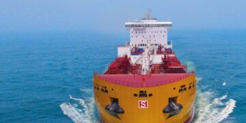
The Houston Ship Channel is on of the busiest and most challenging waterways in the world. The deepening and widening of the Houston Ship Channel, completed in 2005,resulted in a main channel with project depth of 45 feet, width of 530 feet, andbarge lanes on either side between the Gulf Intracoastal Waterway and Morgan’sPoint
A cross-section of the improved channel shows:
- a main channel dredged to project depth of 45 feet and width of 530 feet;
- 35-foot wide transition slopes on either side of the main channel,measuring 45 feet deep at their innermost point, and 12 feet deep at theiroutermost point;
- 200-foot wide barge lanes outside of the transition slopes, measuring12 feet deep; and,
- width of the entire channel along this reach as 1000 feet.
Navigable space within the barge lanes includes the 35-foot transition slope, for atotal navigable width of 235 feet on either side of the main channel. The outer edgesof the barge lanes are marked with gated beacons in good water, but inner edges areleft unmarked.
Tow operators are encouraged to use the lanes as asafe navigation space, leaving the main channel freefor faster-moving vessels and deep-draft ships.Operators should be aware, however, of hydrauliceffects caused by the new channel configuration.Currents in the barge lanes may run slightly faster dueto their shallower depth, and forces exerted bylarger displacement ships will be amplified. Seethe sections on Deepdraft / Tow Interactions andMooring Issues for additional details on the impact ofhydraulic effects.

Every vessel type transiting the Houston Ship Channel has its own uniquenavigational challenges and limitations. In order to maintain a safe environment,it is important to understand the differences between vessel types, and how theiroperation impacts others on the waterway.
Areas Requiring Special Attention
| Area | Challenges |
| Intersection of the Gulf Intracoastal Waterway and theHouston Ship Channel | Traffic congestion, current, wind and weather, inconsiderateor uncooperative mariners, radio congestion, marinerinexperience, unmanageable tow size, ship speed |
| Lynchburg Ferry / San Jacinto | Traffic congestion, line of sight, current, presence of the ferry,blinding lights at the shipyard, poor communication |
| Dredge locations (various) | Channel restrictions/closures, poor communication, one-waytraffic, uncooperative mariners, location of equipment |
| Manchester | Narrow passage, line of sight, congestion |
| Morgan’s Point Highlines | Barbours Cut and Cedar Bayou intersections, high traffic areasubject to congestion |
More information and guidelines for the safe navigation through the Houston Ship Channel may be found at the guide below issued by the Houston-Galveston Navigation Safety Advisory Committee