


Satellite technology provides accurate information about life on Earth
 From tracking icebergs in the Arctic to counting penguins in Antarctica, satellite technology continues to provide ever more detailed and accurate information about life – and its risks – on Earth.
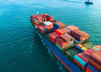
Improvements in data-acquisition and more sophisticated software mean that even in crowded shipping lanes it is easier to single out an individual ship and an Emperor penguin can be distinguished from a shadow on the ice. With miniaturised satellites now available, the much lower costs involved have helped launch a swarm of such space-based monitors feeding data to scientists, governments and commercial interests.
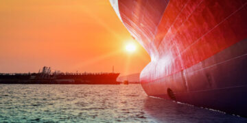
The pros and cons of satellites have been recently identified in the detection of icebergs in the North Atlantic region where the Titanic had its fateful encounter. The International Ice Patrol (IIP), the iceberg-monitoring service that was established following the disaster 100 years ago, is currently evaluating them and, while they offer a cheaper version than that provided by aerial surveillance, they have yet to pass the test with flying colours.
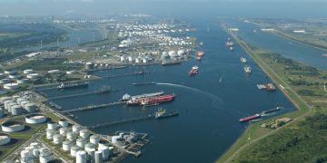
The IIP found radar-based satellite surveillance had failed to meet its demanding requirements, with one of the main problems the inability to detect small icebergs. Getting satellites to distinguish a ship from an iceberg also remains “a significant challenge”. Another problem for the IIP is the increasing activity of the oil industry in the Grand Banks area. The more aircraft, vessels and drilling platforms there are, the more “targets” have to be identified, although they also provide more sources of information for the IIP. After satellites, merchant shipping was the second biggest source of information on icebergs in the area last year.
Last year’s ice season, incidentally, was the fourth in the last seven years in which no icebergs threatened trans-Atlantic shipping lanes. This, the IPP noted, meant shipping benefited by shaving hundreds of miles off voyages, so cutting the fuel bill at a time of high bunker prices. While it has yet to be confirmed as part of a long-term trend (the IIP attributed the lack of icebergs to unusually warm air off eastern Canada), it will provide warming news to those who see ice-free Arctic waters as potential maritime short-cuts.
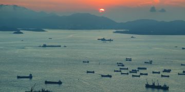
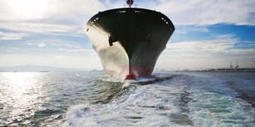
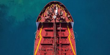
While work on improving satellites’ ability to detect icebergs continues, monitoring shipping worldwide through the capture of Automatic Identification System (AIS) signals is being advanced with the help of the International Space Station (ISS). Astronauts have been busy installing the necessary equipment that could make easier the task of identifying individual ships in even the busiest shipping lanes where signals are often lost or mixed.
Some idea of the scope of the satellite-based coverage can be gleaned from the statistics: around 400,000 ship positions from more than 22,000 different ships are received “on a good day” and, in a summary made in October last year, more than 110 million position reports had been received from 82,000 different ships since the trials began in June 2010.
The trials on monitoring global maritime traffic are being carried out by the European Space Agency (ESA) using the Columbus laboratory module on the ISS. The space-based Vessel Identification System (VIS) will, the space agency says, help European authorities in areas such as fishery control, maritime pollution, safety and security, including search and rescue and anti-piracy efforts. Last year a European satellite located and tracked a hijacked tanker using AIS data, although this could not prevent the ship being taken to Somalia where it and its crew were held for 10 months.
Similar space-based monitoring is being carried out separately in different parts of the world. Norway, with the largest area of sea in Europe, launched its AIS satellite in 2010 to keep track of ships and fishing vessels in the Arctic region known as the “High North” where activity was increasing as the ice retreated and oil exploration was developing.
One of the proposed uses for the Norwegian satellite (a second has since been launched) was identifying ships which failed to keep to prescribed shipping lanes. At the time of the first launch the Norwegian authorities said satellites using radar could also tell them where ships were but not their identities. Another use could be in spotting oil slicks deliberately caused by ships, a surveillance activity currently and expensively undertaken by aircraft.
The US in the post-9/11 era of heightened security awareness also began using AIS-fitted satellites to monitor shipping in its “maritime domain”, an area up to 200 miles offshore.
The ESA project is more ambitious in trying to achieve global coverage. A fully functioning VIS will fill the gaps in the shore-based AIS system that is limited to a 40 nautical mile horizontal range and leave even fewer places for ships to hide. Early problems with AIS, that included incorrect IMO number, call-sign and name of ship, appear to have been largely overcome since it was introduced in 2003, although dozens of named ships were reported to the International Maritime Organisation in the last quarter of 2011 as illegally transmitting either incorrect data or no data at all.
Such monitoring, whether from space or land, assumes, of course, that ships, technical problems aside, are keeping their AIS switched on. There may be justifiable reasons – for example, to avoid detection by potential hijackers – for not transmitting AIS, but there may also be more suspicious motives behind “AIS silence”.
The ESA says it has already received a number of requests from “service entities” for access to VIS data and commercial interest in VIS data should be as strong as it has been in AIS. With an asset as mobile as a ship, keeping track of both its whereabouts and that of its cargo is useful to all those with an interest in it.
Exactly who should be allowed access to data that can be commercially sensitive remains as controversial an issue as it was when, under the Long-Range Identification and Tracking (LRIT) system, ships were required to regularly report their positions. Concern then was eased by the adoption of a system of checks and counter-checks.
Source: BIMCO, Andrew Guest