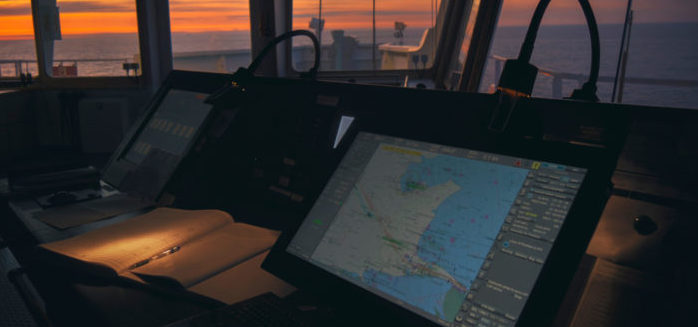
Living in the digital age, the way that a voyage is planned is easier and quicker since all data and information are available on demand, with just one click, and all updates are introduced immediately upon receipt. There are no doubts that the benefits of e navigation in respect of time and effort during Appraisal and Planning stage, are beyond expectations for navigators. How many of older mariners haven’t spent hours and days correcting an endless pack of paper charts and publications, with continuously changing Notices to Mariners or other corrections?
Correction of charts and publications through e-navigation means is extremely quicker than with paper charts/publications. The availability of required charts and publications per voyage is imminent since we do not have to wait to purchase new charts and publications for the area of interest. For planning stage, it is also very helpful that operators only conduct the planning once. For example, if they change the used scale, then automatically the planned track along with set parameters and precautions are transferred to new called chart.
On the opposite side we had to plan the voyage to small scaled charts (generic) and then transfer the routes/way points to larger scaled charts taking all risks for inadequate transfer. Same, when the plan needed to be revised (during execution stage), a correction on ECDIS display is automatically transferred to all scales while during paper navigation again all relevant charts needed to be revised.

A challenging issue for each navigator is to know the exact position of the ship in relation with the planned track. The most beneficial tool of e navigation is that the monitoring is being done on a real time. Navigator knows the exact position of the ship (based of course on satellite positioning systems), with a look on the screen. He/she has to do nothing but monitoring. With traditional paper navigation the most accurate position was the three lines (bearings and/or ranges) taken simultaneously by the navigator.
The plotted position marked on chart was already a past position (where the vessel was at the time the navigator received the bearings). Taking into consideration that a ship under a speed of 10 knots covers a distance of 1000yds in 3 minutes, 700 yards in 2 minutes, 350 yards in 1 minute then it is easily understood that the delay of receiving and plotting the position on the chart marked a past position and not the current position. Imagine the Master’s position in narrow / restricted sea areas where the safe area for navigation often is less than a nautical mile, how anxious and careful was during paper navigation, just because he knew that the plotted position was not the current position of the ship.
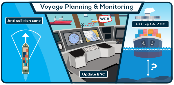
This actually explains why navigation accidents still happen despite the use of e-navigation. All electronic means for navigation introduced to be supportive to navigator and not to replace the awareness. Using safety contours, anti-collision cones/boxes and No GO areas, is to create a safer planning environment for the mariner. But the final decision still stands on the mariner. Over relying or misusing ECDIS may lead to unpleasant situations for the ship.
If one does not know how to use the parameters to set the ECDIS (ship dimensions, safety margins, safety contour, under keel clearance etc), then the result of planning may lead to a false sense of safety. In essense, ECDIS is only a tool that produces results in accordance with the received input from the operator.
The monitoring stage using ECDIS is much accurate and simpler but on the other hand leads the navigator to a situational awareness lose, due to false sense of safety. The alarms used for warning often are ignored or much worst put in silent mode due to an alarm fatigue, created by the produced results of inadequate planning and ECDIS setting.

So, what is the solution? Mariners should understand that the ECDIS is a useful tool. However, the ECDIS alone cannot navigate the ship or correct any mistakes. It can only be used to help operators navigate better and easier. Thus, the mariner is the one assigned with the duty of correct use. Prepare the voyage, plan the routes, check the plan , monitor the plan using the new modern ways but remain anxious and keep the situational awareness that you had during old way of navigating; this is what navigation with ECDIS actually means.


































Another question is why ecdis compulsory on big ships with more persons and not compulsory on small ships with less persons?Demands are putting position every 3min or 10min and monitoring that ship is navigating on safe route in narrow chanells or straits etc. The discrepancy is big ships are enough person to do this job and report to master and they have compulsory ecdis. But unfortunately small ships are not enough person and sometimes, mostly masters have to be on bridge alone and there is no cumpulsory ecdis. And if accidents occurs in narrow channells or etc. because of not monitoring ship’s position properly than we are trying to find out lesson learned about this case and that lessons are expecting to be learned by master. Root question is this ” what lessons are learned by people who making that rules”
At age 55 I‘d still happily navigate on paper charts if they could please stop discontinuing them in a reasonable scale. My problem is that Ecdis uses 3 things, ARPA Radar, GPS and AIS. 3 things to go wrong. So many smaller vessels are moving away from paper chart navigation and when the power goes out you may as well be in the dark. At least with charts you can continue to dead reckon (if chart is still at a reasonable scale!) your position if you lose a system. I come from offshore oil and gas, and now “semi retired” on Tugs. The arguments for ECDIS accuracy in the above story are only valid while the electronics are accurate. In my experience, electronics are not becoming more reliable as time goes on. I believe chart based navigation gives you a better awareness of your surroundings. The young ones out there may think I’m a dinosaur, but I guarantee you will never be involved in a dangerous close quarters situation with me.
Cheers to all