


China to rule the seas – unmanned
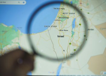
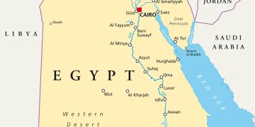
 In the cold blue waters between China and Japan, a Chinese fishing craft collided with two Japanese coast guard patrol boats near the uninhabited islands in the East China Sea known as the Diaoyu Islands in China and the Senkaku Islands in Japan. Following the collision on September 7, 2010, coastguards boarded the trawler and arrested the Chinese crew and captain. Following the incident, anti-Japanese protests were held in many Chinese cities, Chinese tour groups visiting Japan were recalled, and a decision was made to suspend the export of rare earths to Japan.
The strength of reaction in this seemingly small-scale maritime accident is a symptom of a deeply rooted conflict. The islands occupy a sensitive position in China-Japan relations – they were first seized by Japan in the Sino-Japanese war of 1894-5, with the annexation of Taiwan and Korea, followed by the invasion of China by Japan in the 1930s.
The conflict continued as the waters were filled with ships again in October 2012, this time naval ships. The Chinese Navy’s East Sea Fleet and civilian maritime patrol agencies conducted their annual joint maneuvers simulating a situation where Japanese law enforcement vessels obstruct and interfere with Chinese maritime surveillance and fisheries administration vessels. The simulated scenario included a collision in which the Chinese ships are damaged and personnel are hurt and fall into the water, requiring further support of a frigate, a hospital ship, a tugboat, advanced fighters and helicopters for support, cover and emergency rescue.
Advance in time to just a few short years later: it is 2015, and drones are returning to special unmanned aerial vehicle (UAV) bases, crossing disputed national airspace while surveying activity around the respective islands. The searching multispectral sensor scopes the waters for signs of civilian and military activity near the territories. Tensions heighten due to the ever-present, ever-watching, barely seen spots in the sky.
These scenarios give context to China’s recently declared intention to deploy marine surveillance drones to track activity around the archipelagos – an action that may set a precedent for dealing with controversial, disputed territories throughout the region. China’s use of drones facilitates an old strategy of perception politics that helps enforce its territorial claims over disputed islands. Drones also expand China’s regional military power as they induce broad, invasive footprints of surveillance. Additionally, drones reduce the necessity of maintaining diplomatic sensitivity because they are a dehumanizing tool that further distances surveyors and objects of surveillance, the bullet and the target.
China is developing civilian and military varieties of drone technologies as part of a strategy to “accelerate its transition from territorial air defense to both offensive and defense operations, and to increase its capabilities for carrying out reconnaissance… ” The PLA Air Force is investing in long-range reconnaissance and armed drones, and at a pace and lack of transparency disturbing to regional and US military interests. In 2010, China revealed nearly 25 different models of drones at the Zhuhai air show – whereas reports indicate that two years earlier China had displayed only a few models.
The expansion of indigenous drone technology results from US intervention in the early 2000s, when the US leaned on Israel to stop exports of the Harpy UAV to China in response to Taiwanese concerns that the nearly 100 drones would threaten the island’s security. At this year’s Zhuhai air show, the China Aerospace Science & Industry Corp (CASIC) revealed six new drone models (military and civilian), and Aviation Industry Corp of China marketed an armed Wing Loong UAV.
For more information, click here
By Elizabeth Van Wie Davis and Margaret Albert
Source: Asia Times Online